A short history of Preshute Parish
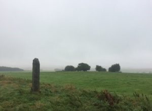
Misty day on Manton Down
The area we know today as Preshute has been inhabited from at least Neolithic times. Roman settlements have been discovered on near Manton House. The name Preshute (meaning Priest’s Cell) comes from the original name for the church at the eastern end of Preshute Lane, Manton. However, Preshute parish, or the area that defined it subsequently can trace its beginnings back to the land development around the Mount (now within the College’s grounds). A Church was built in the 11th century to the west of the Mount and along with the significant lands encircling it, called Preshute. The new parish surrounded the town of Marlborough.
In the 13th Century the parish appears to have been divided into Elcot tithing (largely to the east of Marlborough) and the King’s Tithing. The hamlets of Clatford and Manton and probably the church, were included into the western Preshute parish. The parish also included two areas of surrounding downland – one owned by the Crown and the other by the Templars were added as well as the area now known as The Common. The first mention of Clatford Manor appears to be 1066, when it was owned by a gentleman called Alwin. The estate passed to the Mortimer family and in the 12th Century became a small priory. Over the coming hundreds of years, the manor and its surrounding farmland changed hands many times. In 1923, Clatford farm was sold to J.B. Wroth. The farm was sold again in 1978 but today, 2 members of the Wroth family still serve as Councillors on Preshute PC.
From the mid 16th century to 1901 Preshute parish stretched 10km from the north-west by the Ridgeway at Hackpen Hill (269m) across the Marlborough Downs and the Kennet valley to the south-east adjacent to Granham Hill (183m), the Swindon to Salisbury road and the Wansdyke.
In 1901 Preshute was divided into Preshute Within and Preshute Without. Preshute Without included Clatford and Manton parts of the downland to the north of Marlborough and The Common. Preshute Within included the Church and lands to the south-west of Marlborough and St.Margarets was absorbed as a civil parish within the borough of Marlborough. Preshute Without was simplified to just Preshute parish in 1925.
Preshute historically has been a prosperous community and in 1334 was taxed forth highest of the 10 parishes making up the Selkley hundred. In 1377, it is recorded that there were some 139 poll-tax payers. By 1871, Preshute Without counted 1,374 souls – largely because of the growth of the Manton House racing stables and Marlborough College. Boundary revisions reduced that number to 615 by 1931, reducing again after Manton was absorbed into Marlborough in 1934. Today, the population is shown as 192. In 1773, there was an inn called The Plough on the south side of the Bath Road at Clatford – long since closed and now a private residence.
Today, Preshute parish is a thriving rural community with three principal settlements at Clatford, Manton House Estate (including two horse racing yards and the Temple Farming Estate. The A4 London to Bath road runs east to west through the parish. A busy industrial park at Clatford on the Bath Road characterises its commercial activity with most other employment in farming, estate husbandry and equestrianism.
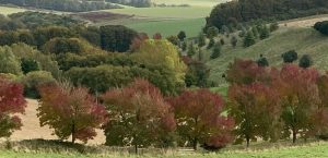
From a geological viewpoint, most of Preshute is on the chalk of Marlborough Downs, and located within the North Wessex Area of Outstanding Natural Beauty. The parish is criss-crossed by many ancient public Rights of Way. From the sarsen littered downs at Fyfield (near the Devil’s Den), the unique environment of the chalk stream River Kennet and the tranquillity of West Woods, Preshute is surely one of the most beautiful parishes in Wiltshire.
Principal reference:
British History Online: A History of the County of Wiltshire, Volume 12, Ramsbury and Selkley Hundreds, the Borough of Marlborough. First published 1983.